

Update, December 2022
The Yellow Point Trail idea is still cycling through the hoops of government.
- The Ministry of Transportation and Infrastructure (MoTI) has been asked to continue widen the side of the road from Code Road to the Kiss & Go (Park & Ride) up by the highway.
- With the federal gas tax awarded to the project, the CVRD is hiring an engineer to determine where exactly Phase 1 of the trail will go. We’ve been told it will probably go from the Chuckwagon Store towards the North Oyster Fire Hall. How far they’ll get with the money they have ($380,000) is still unknown.
- The new Regional Director for RDN Area A, Jessica Stanley, has attended a Steering Committee meeting and has been briefed on the project and will do her best to influence her Parks & Trails people of the importance of getting the project done—especially around areas that children walk to school.
- CVRD’s Area H Director Ben Maartman had a chance to chat with MoTI Minister Rob Fleming so he is aware of the project as well. He realized there’s difficulties with their Active Transportation grants when the project scope is as big as ours. With any luck, he’ll figure out how it can get done more efficiently.
- The CVRD hired a company to look at all the active transportation routes real and imagined throughout the entire area and solicited the public’s help in prioritizing the most important ones. The Yellow Point Trail has been deemed very important. They will publish their full report soon. To access it, go to Plan Your Cowichan.
- We are still working on getting help from the Stz’uminus Band with a possible link through Oyster Sto’ Lo to the Kiss & Go making it easier for everyone to get to businesses there without the use of fossil fuels. Got any ideas?
- The TransCanada Trail is another issue we want to tackle. Could our trail be the link people could use who want to travel from the Cowichan Valley Regional Trail to the Nanaimo Parkway Trail? Could we become a hub for all trails in the area? With the help of the Nanaimo Airport who has publicly said they will build a trail on their land over to the Cottonwood Golf course.
If you’re interested in helping out with any aspect of this project, give Pamela a call at 250-245-9155
Update, October 1st 2021
Citizen Survey
A few keen local citizens donned their hiking boots and clip boards and walked the proposed trail from the Chuckwagon Store to the Crow & Gate. They were looking for two things: the answer to the questions, “If we had a trail on just one side, which would it be?” and “What natural and man-made impediments are in the way of creating a trail. Everything from culverts to boulders to hydro poles and fences was carefully marked on maps. The information was put onto a map using GIS technology by Carrie-Lynn Robinson, a VIU GIS (Geographic Information Systems) along with actual photos of the troubled spots. It is hoped that all this work will save money in the long run when we put the “shovels in the ground.”

Our conclusion is that a widened shoulder is feasible, but we need a feasibility study for the separated multi-use trail, which may need some detours. We presented the survey results at the second meeting of the Joint Management Committee in April with MOTI, RDN and CVRD, and we are working with the RDN and CVRD Directors for support to apply for Active Transportation Funds or Gas Tax to fund this. We also presented a proposed Terms of Reference for the Committee and need further board approvals to move forward on this.
Widening More Shoulder
MOTi has now complete the shoulder from Haslam to Yellow Point Road on one side, and plans to install a shoulder on the other side back to Code Rd and then to the Highway. There is a path on both sides of the road from Quennel to Yellow Point Road.
Trans Canada Trail Link
We have had discussions with CVRD and RDN staff in regards to the Trans Canada Trail. The trail could come from Ladysmith to the Diamond and along to Cedar, across the highway to the Park and Ride, along the secondary road to the east of the highway to the airport, around the airport on a dedicated trail to the golf course, and then down Haslam Road and along Cedar Rd. This change in the route would mean that the Trail would not have to stop at the Nanaimo River where it waits for money for a bridge to be put in. Funds already allocated for the bridge could be used to create a dedicated off-road path instead. A path through the airport lands has already been proposed and is awaiting approval from the Nanaimo Airport Board. More on this soon!
Yellow Brooms
Yellow Brooms have been put up around Cedar Road where the pavement has been widened to accommodate bicycles and buggies and buddies walking side-by-side. To keep the path free of gravel, we have installed a few yellow brooms. Help everyone out by brooming away the rocks as you roll by. Together, we can make it better.
Yellow Point Trail Video
We are making a short video about the need for the Yellow Point Trail . If you’re interested in seeing your name in lights, give Pam a call. 250 245-9155.
Support for the Trail
New Yellow Point Trail business cards have been designed and printed. We are handing them out to people in the area who are interested in and would like to know about the trail. If you’d like some, let us know; we have a limited supply.
We are planning a future public meeting on the trail. If you would like to be on our mailing list please sign up and indicate your interests on the form HERE.
Update, December 18th 2020
The RDN, CVRD and Ministry of Transportation have approved YES leadership of the new Joint Management Committee, and our goal now is to find $28,000 to pay for a Feasibility Study for the proposed trail.
Thanks to all the Yellow Bikes publicity and community support, the Ministry of Transportation decided to prioritize adding a paved bike lane to Cedar Road between Code Road and Haslam Road, which is now complete, and just awaits painting. We have asked if they can extend it up into Cedar, but that will depend on their next year’s budget. We asked if they could paint a double white line to separate the bike path from the road to create more safety for cyclists, but they resisted, saying it would cost an extra $50,000, which was not in their budget. We still aspire to have a properly separated multi-purpose trail along that stretch.
Previous Updates
The community response to the Yellow Bikes, the article in Take 5 Magazine, and on the Cedar and Yellow Point Facebook groups has been very positive. 90% of the comments on Facebook are either enthusiastically supportive, or supportive as long is taxes are not raised to pay for a trail.
We have a strong committee guiding our way forward. Thanks to everyone who is helping!
On September 15th we presented to the RDN Board, where we received a very positive response. A Notice of Motion was proposed that the RDN name one person to join the Joint Management Committee, and offer its support for the project. This will be voted on at the next RDN Board Meeting on October 27th
On September 15th we presented to the CVRD Electoral Area Services Committee, where we received a similarly positive response, referring our request to the CVRD Board on October 14th. This is the slide deck that we presented:
Our Vision
We have a vision of safe, healthy, sustainable travel and recreation in the Yellow Point area – and everywhere.
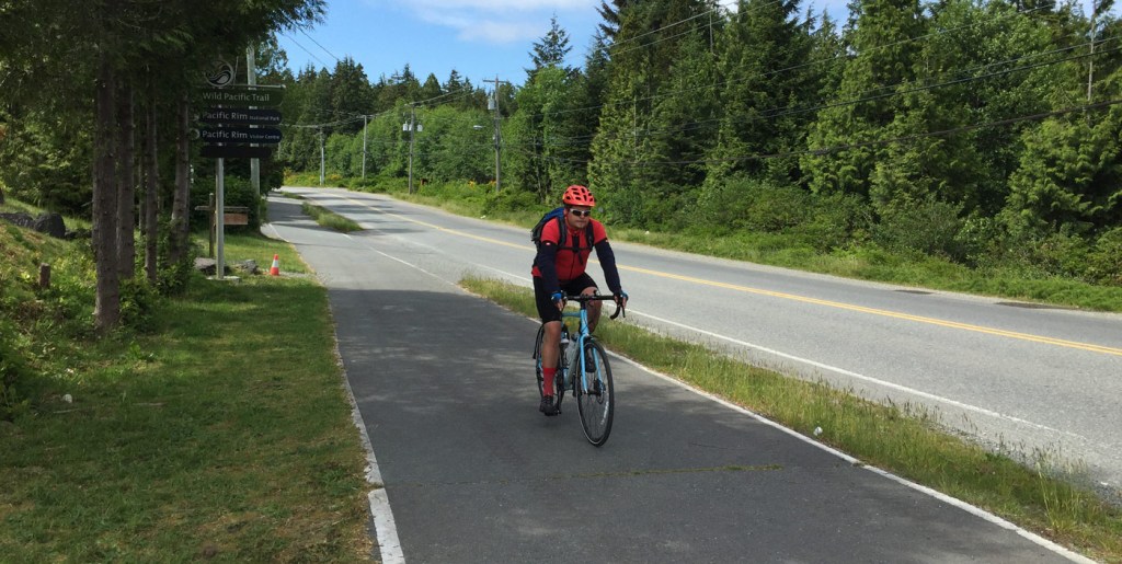
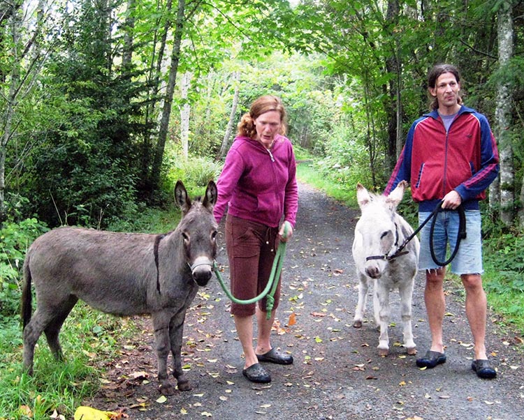
We believe there is a strong need in Yellow Point for a safe separated trail that could be used by walkers, cyclists, mobility devices and, in some areas, horse riders.
Practically, there may need to be a combination of trail designs to suit local conditions and the cost of building, with a separated trail in some areas and a widened shoulder in others. The trail’s development could also be phased to address areas of higher need first.
The Proposed Route
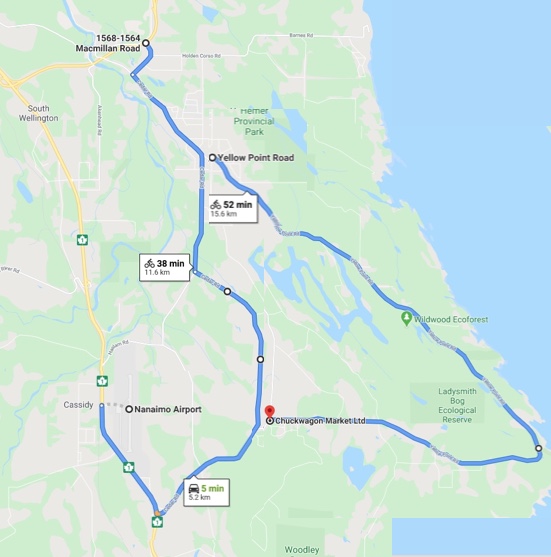
We propose a 22 kilometres multi-use trail connecting local parks, schools, businesses, markets and community centres, in a circular route around Yellow Point and Cedar roads, with 10 km of connectors:
(a) from the Chuckwagon to the Highway 1 / Cedar Rd S. Park and Ride and to Nanaimo airport/bus stop
(b) From Cedar Road N. to Macmillan Road, on the way to the Duke Point Ferry.
Local Connections
The trail would connect users to nine parks, including Hemer, Roberts Memorial, Yellow Point Park, Wildwood Ecoforest, and the Ladysmith Bog Ecological Reserve, and to:
- Farms, farm stands, agricultural recreation, McNab’s corn maze
- Schools – Cedar Elementary and Secondary, North Oyster and Woobank
- The softball fields in Cedar
- Churches – Cedar United and St Phillip’s Anglican
- Cedar and North Oyster community centres
- Businesses, stores and markets, including 49th Parallel Grocers and Friesen’s
- Resorts and campsites, including Yellow Point Lodge, Zuiderzee, Inn on the Sea
- Pubs, Cafes and Restaurants, including the Crow and Gate, Coco Café, Slice Resto, the Mahle House, the Wheatsheaf and the Cranberry Arms.

Where Should the Trail Go?
The path would be built within the existing Right of Way (ROW), on land that is owned by the province. The roads along the proposed route are typically 6 metres wide on a 20 metres ROW, allowing 7 metres of space on either side for a trail. In some areas, the property lines are wonky, so the layout may need to vary.
In many places the roads are unsafe for non-car users, with blind hills, blind bends, narrow shoulders, and some drivers who are just going TOO FAST!
Cedar Rd has a fog line and narrow paved shoulder, but Yellow Point Road is mostly without a paved shoulder and is probably more dangerous.
Potential Path Users
- Our kids walking to school
- Cyclists commuting, exercising and volunteering and touring
- Neighbours visiting
- Dogwalkers going to the parks
- Horseriders
- Businesses and community services – bike repair, coffee shops, farm stalls, softball players
- And so much more

Future Potential Connections
In the long run, the train could connect to other present and future trails:
- The Great Trail (Trans Canada Way)
- The Salish Sea Trail
- Great Blue Heron Way (Tsawwassen)
- E&N trail
- Cowichan Valley Trail
- Ladysmith Heritage Waterfront
- Chemainus Trail

Gathering Support
We have received letters of support from
- Paul Manly MP
- Doug Routley ML
- School District 68
- Ladysmith Chamber of Commerce
- Nanaimo Airport
- Mahle House
- North Oyster School PAC
- Yonder Wood
- 49th Parallel Grocery
- Cedar United Church
- Diane Andrews, Mid-Island Horse Country
What’s Next?
We need to:
- Demonstrate sufficient local support for the project
- Engage key stakeholders including MOTi, CVRD and RDN to plan the project
- Form a broader committee and a RDN Area A/CVRD Area H partnership, to advance the project,
- Obtain funding for an initial Feasibility Study
- Complete the various project stages, including
- Planning and conceptual design
- Preliminary design
- Detailed design
- Tender and construction
- Timeline could be from 2 to 10 years
Finding the Funding
We are looking for funds that are available for green infrastructure projects:
- BC Active Transportation Infrastructure Grant
- Gas tax
- COVID Community Infrastructure Grant
- Other grants and donors


If you are interested to help, please contact Pamela Walker, 250-245-9155. If you’d like to share your thoughts, or make a comment, scroll down below to “Leave a Reply”. Thanks!

Great ideas, 🚲
LikeLike
Great idea…could you somehow annex the Cedar By the Sea neighborhood.? We have no safe access in and out of our community. Picked up a sight impaired man who was walking up the dark S curves on Barnes in the pouring rain. He was coming home from an eye exam and the bus dropped him at Holden Corso and Woobank! Kids on their bikes take their lives in their hands just to get to safe biking routes.
LikeLike
Thanks, Jan. We should add this to our thinking.
LikeLike
If this proposed 22 kms of gravel bicycle trail is going to be used by walkers, cyclists, mobility devices, electric scooters, and horse back riders, the trail is going to require regular maintenance. Who’s going to pay for the regular maintenance fees. Is this another fee that’s going to end up on our property taxes? or is the Ministry of Highways going to pay for this? I would support the Ministry of Highways upgrading Yellow Point Road with road grade paved shoulders for each side of the road because there would be no maintenance work involved or additional fees for property owners. I think the largest user group, the Nanaimo Bicycle Club, could possibly consider taking on another local upgrade project by working to turn the defunct E&N railway line into a functional cycling trail. This is currently being considered in Victoria and makes a lot of sense to me… a bicycle trail from Nanaimo to Victoria!
LikeLike
These are all important questions that we need to address. We understand that although the Ministry of Highways owns the right-of-way, the two regional districts will be responsible for maintenance and upkeep. We are hoping that the work of building the trails will be paid for by means of a provincial grant for active transportation. There are many bike lanes and trails in BC.
LikeLike
Yes, I agree. If you live anywhere east of the S-Bend on Barnes, you can’t even think of letting your children bike into town because of that part of the road, including the hill on Barnes before the Lassum cow pasture. It severs that part of the community from the rest, and from the children’s school. It is even difficult for an adult to walk that stretch of road safely, as you point out.
LikeLiked by 1 person
Thanks, Karen – have you been on contact with Pamela, who’s heading up this campaign?
LikeLike
Hi – I suggest that the two connectors could encourage the biggest number of users in the shortest period of time.
LikeLike
I like the idea of a safe place to bike, walk, and hike while still leaving Cedar a rural community , but please remember to make the trails horse accessible as well.
LikeLike
Good idea!
LikeLike
Great idea and one badly needed for safety reasons. It should include a route from Nanaimo. As such it would attract many tourists such as Whistler does with its 60+km of paved bike paths. It would include more bikers and help reduce cars.
Tom Hutton
ps How about a side branch from Morden mine, a bridge over Nanaimo River, along Hemer Park and back up to Yellowpoint.
LikeLike
Ideally, yes! The bridge over the river has been planed and designed, but I think it’s on the shelf due to cost.
LikeLike
Also a connecting path into Ladysmith would be awesome. I guess start somewhere, but gave phases?
LikeLike
One hope is that there can be a long-distance trail running down the E&N Railway corridor. That would make it easy to connect a future Yellow Point Trail to safe bicycle travel up and down the Island.
LikeLike
I support this initiative in principle. I would want to know where exactly the walking/hiking portions would be and with how many different user groups it would be shared.
LikeLike
Would love to see this happen, as wide as possible for the multi-use idea.
LikeLike
Love this idea!! I would love safe biking, walking, running paths!!
LikeLike
i do not live in the Cedar area but i think it is a wonderful and safe idea and perhaps (due to cost n taxes) it could be done in phases. i would def use this trail as i love the area. i would also volunteer some of my time to help with what ever you feel you need help with.
LikeLike
Thanks Sandra. Can you send us an email to yellowpoint2020@gmail.com, to share where you live, and any particular skills you have that might help?
LikeLike
Really not a fan of the ideal. Appears to be a pipe dream. For example on yellow point road theyre multiple pull offs for communal mailboxes, how would this be incorporated into a trail or subsequent driveways that are back to back. The additional traffic now backing onto former private yards. Who pays and supports the cleaning, upkeep and maintenance? Many blind corners on yellow point make this difficult to conceptualize. Pulling out of the many dipped and raised side streets to cross a potentially busy walking, biking trail that will attract people to the area concerns me.
LikeLike
Thanks for this. These are all good points – they are the kind of detail that will be looked at in the Feasibility Study stage of the initiative. It’s not possible to answer them until there is a study of where and how the Trail could go.
LikeLike
I have raised two boys on the S-bend on Holden Corso/Barnes Rd. They are currently 12 and 14 and I STILL do not feel ok with letting them ride their bikes anywhere as they would have to navigate the no-shoulder/ blind corners on the S bend. I have lost 2 pets on this road over the years, even though our property is completely fenced, and there are frequent accidents there (I hear them all) as the roads that enter onto Holden corso (Lantern and Barnes) are in blind spots for the main traffic. I grew up in the city, and I rode my bike everywhere. Sadly, here I am in the country, in beautiful Ceda and the roads are not safe for children, or even adults. Not too long ago, an elderly man riding his bike, was driven off the road, nearly costing him his life. My neighbor actually trailers her horses 5 minutes down the road to ride at Hemer Park!
I would like to do everything I can to help, and also add a route from MacMillan to Cedar-by-the-Sea. Jan is right, people from there are isolated. Kids can not walk to high-school, or ride to the bike-park safely. Adults would like to go to town or to enjoy Hemer trail by walking/biking/ riding their horse… We live in the most beautiful area ever, without this freedom! All because there is no safe way to navigate the S-bend on Barnes safely. At a minimum, or as a starting point, we need this. This would also connect the Yellow Point routes to the Cable Bay trail, too.
I appreciate the research you are doing to make this a reality and together, Yellow Point/Cedar residents can make it happen!
LikeLike
Thanks for your support, Karen. If you send an email to yellowpoint2020@gmail.com we could add you to our mailing list.
LikeLike
I like ‘The Yellow Brick Road’ as this isn’t exclusive of the rest of Cedar, and everyone is familiar with the name. It has great fame, for a famous tourist area.
LikeLike
I am so thrilled that this is being considered! We have lived in the area a few years now, and I’ve always said that the one thing I’d love is to have better walking and biking paths. What a great way to connect the area, and for everyone to get out and be active. Also, our oldest is just starting to learn to drive, and trying to teach him to navigate the cyclists around Cedar and Yellow Point is a bit of a nightmare, a multi use path is a great idea.
LikeLike
Many thanks, Sarah!
LikeLike
I agree with Tom Hutton and with Karen Jones(but prefer the name currently being used -NOT Yellow Brick/confusing, misleading) I was the Vice-chair to previous RDN Area’A’ Director Alec McPherson on the RDN P,R & Culture committee. keith.wilson@rdn.bc.ca is the current Area’A’ Director. Call me when you have a minute Pam, I will help in whatever way possible as this has been part of my vision for years!
Patti Grand, I will leave you a VM at 9155 Key person to contact is Jim Fiddick, he and other local riders organized the Horse Trail/signage & the ‘Bridge’ over the Nanaimo River is part of that endeavour when we both sat on the Area’A’ P,R & C Committee. There is a Grant application Online, that should be submitted now!
LikeLike
if you are having safety concerns along your proposed route, go to the RCMP and ask to talk to their liaison officer to the ministry of transportation, and be prepared to explain things to them, such as inadequate lighting at dangerous intersections, improper signage, indaequate sidewalks, etc etc etc
for example go look at the intersection on cedar road at yellowpoint road by the north cedar fire department, and just look at how dangerous it is, and i mean really look at it and think of how it can be improved to almost olympic level standards, 21st century street lighting, reflectors, street sweeping, properly painted crosswalks, cutting away bushes that are to close to the road, etc etc etc
i did this once and they dropped over 4 million $$$ on my suggestion
best of luck
LikeLike
Thanks for this cool insider advice, Davy!
LikeLike
Hi Davy, We tried to get hold of the local RCMP liaison officer and, guess what? We don’t have one. But I left the message for the Corporal. Here’s hoping he has $4m!
LikeLike
Excellent write-up. I certainly appreciate this website. Keep it up!
LikeLike